We are a Czech private company engaged in geodetic work. We have been operating on the market since 2002. Therefore, our work is based on long-term knowledge in the field of information technology and geodetic information systems.
The services are comprehensive and necessary for the implementation and operation of each information system, including analytical activities and programming.
We provide materials for projects, we set out buildings and property boundaries, we provide documentation, work in the land registry as geometric plans, easement, digitization, data collection and presentation for GIS and other services.
We provide services to designers, investors, construction companies, utilities administrators, cities, offices, business entities, municipalities, institutions and citizens.
Services:
- geodetic work in preparation of constructions, for project documentation
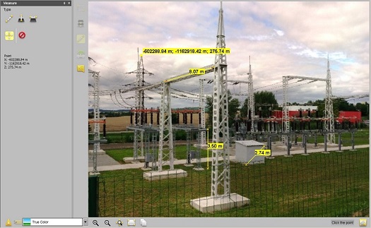
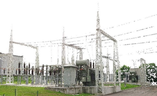
- ground laser scanning
- alignment work in construction and land registry
- measurement of displacements and deformations
- recording the easement in the Land Register
- comprehensive services in the field of geodesy
- data warehouse management
- digitization of documentation
- thematic, purpose-built maps
- passports
- surveying of utility lines
- geometric plans for the division of land and the change of land boundary
- indication of the easement
- geographic information systems (GIS)
- complete consultancy in the field of geodesy and land register
We provide comprehensive IT services and are working to innovate our services every day. A satisfied and always returning customer is always a priority for us.
PICTURES
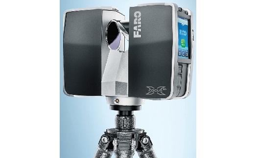
Laserové scanování
Geografické informační systémy
Práce v oblasti geologie
Geodetické služby včetně zaměření

Vypracování znaleckých posudků